The Celestial Sphere
Ancient astronomers perceived the sky as a large sphere with the Earth at its center. They thought the stars were attached to the surface of this great sphere, and as it rotated once each day, the stars would rise and set as they were carried across the sky. We know today that this sphere is not real. The stars and planets are at great distances from the Earth, and their apparent daily motion across the sky results from the Earth’s spinning on its axis. But this image of a celestial sphere which surrounds the Earth at some great distance remains a useful concept. Astronomers have created a grid of reference lines and points on the celestial sphere to describe the position of each star, planet, and galaxy. Every object has a numerical address in the sky and that address is on the celestial sphere. From mid-northern latitudes, we see the stars moving across the sky from east to west. As the Earth rotates, the sky appears to pinwheel about the North Celestial Pole. In the early evening a star rises in the east; at midnight it is on the meridian; and by sunrise it sets the west. The stars and planets seem to be attached to a great dome that encircles the Earth. The dome rotates once each day.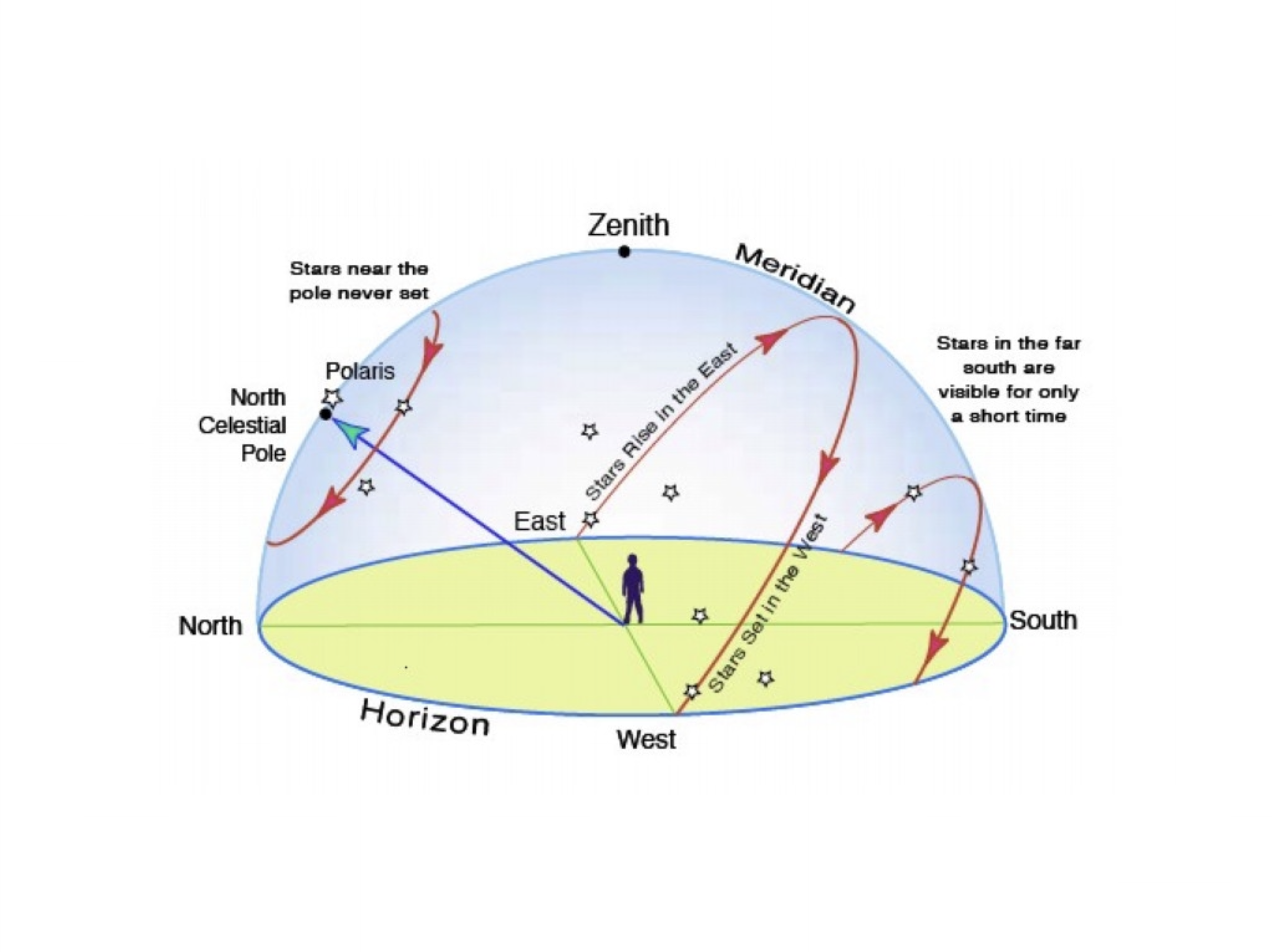
Altazimuth Coordinates
Altazimuth coordinates describe the position of an object with reference to the local horizon. Azimuth is the angular measure along the horizon, beginning at 0° in the north, through 90° in the east, 180° at south, and 270°in the west.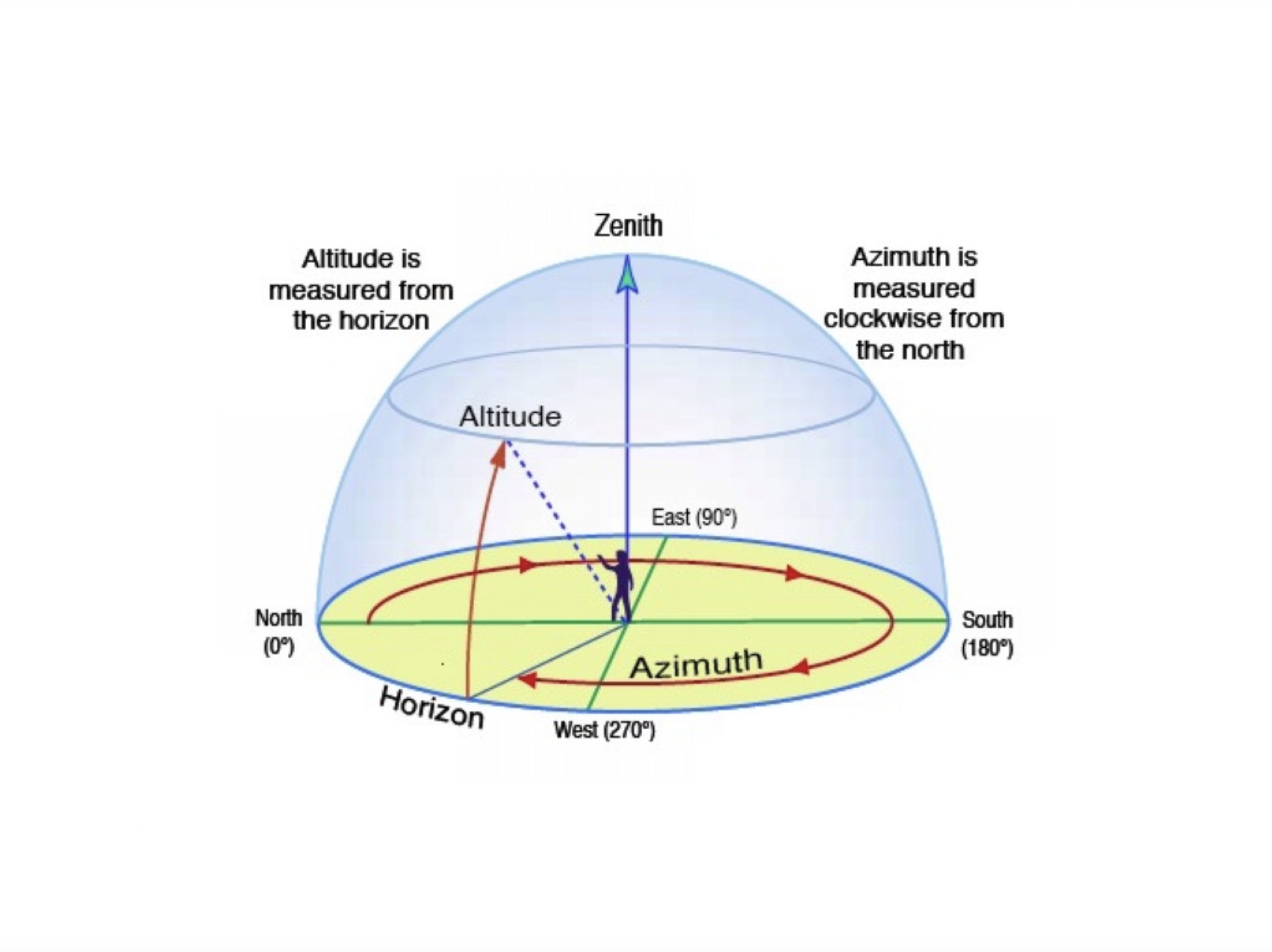
Equatorial Coordinates
We use a coordinate system of longitude and latitude to locate any point on the surface of the Earth. On the celestial sphere we use a similar system called equatorial coordinates, which are based on the Earth’s poles and equator. The Earth’s axis of rotation, extended outward from the North Pole, intersects the celestial sphere at a point called the North Celestial Pole. The star closest to this point, Polaris, is often called the North Star. A similar extension from the South Pole marks the South Celestial Pole. The Celestial Equator is the projection of the Earth’s equator onto the celestial sphere. All points along the celestial equator are equidistant from the north and south celestial poles. To define the location of an object on the celestial sphere, we first determine its angular position along the celestial equator. This coordinate is right ascension, and it is analogous to longitude on the Earth. As Greenwich marks the zero of longitude on Earth, the vernal equinox is the zero of right ascension in the sky. This point marks the Sun’s position on the first day of spring, when the Sun crosses the celestial equator. The vernal equinox is currently in the constellation of Pisces, but the position changes slowly over time.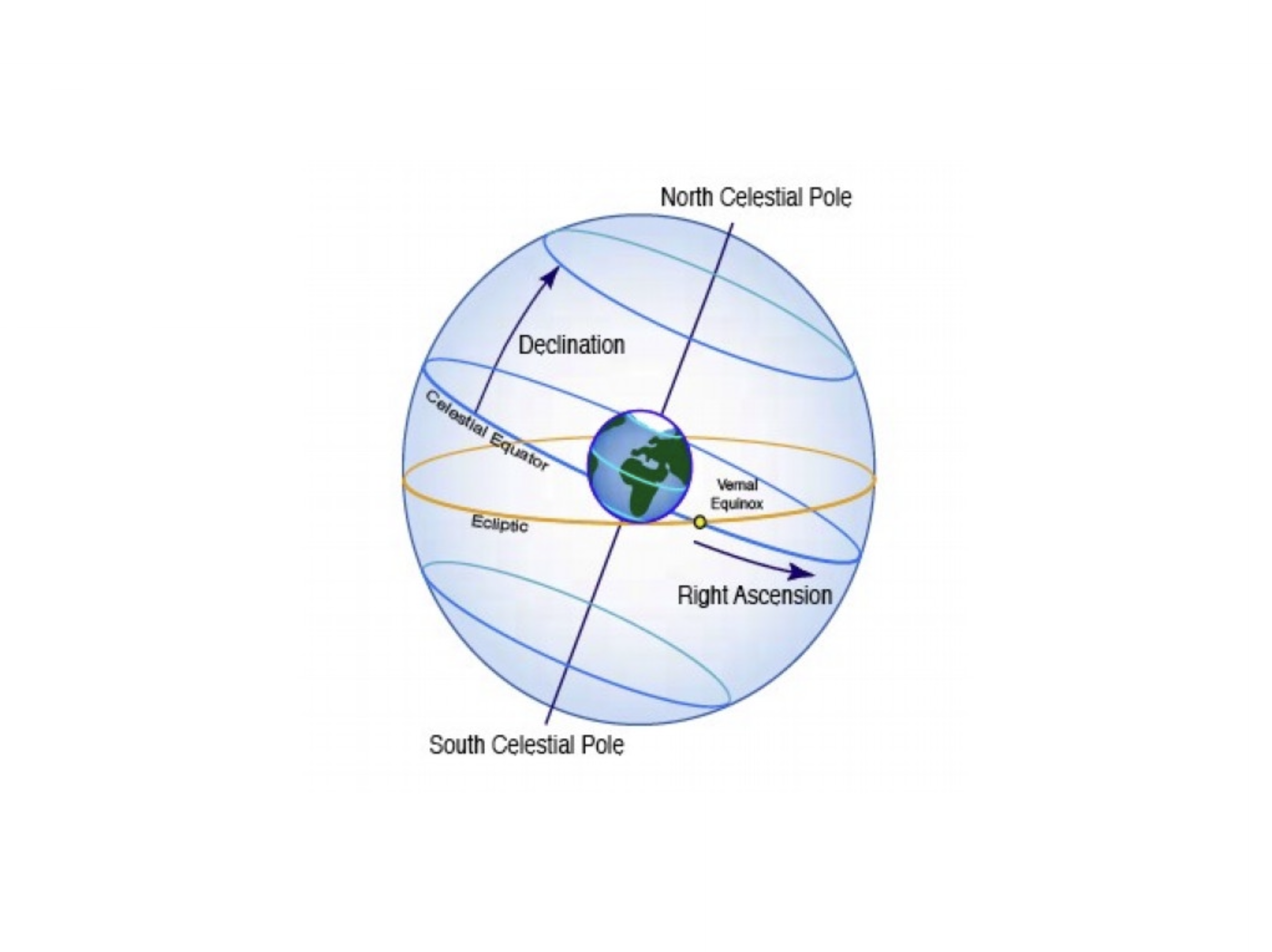
Ecliptic Coordinates
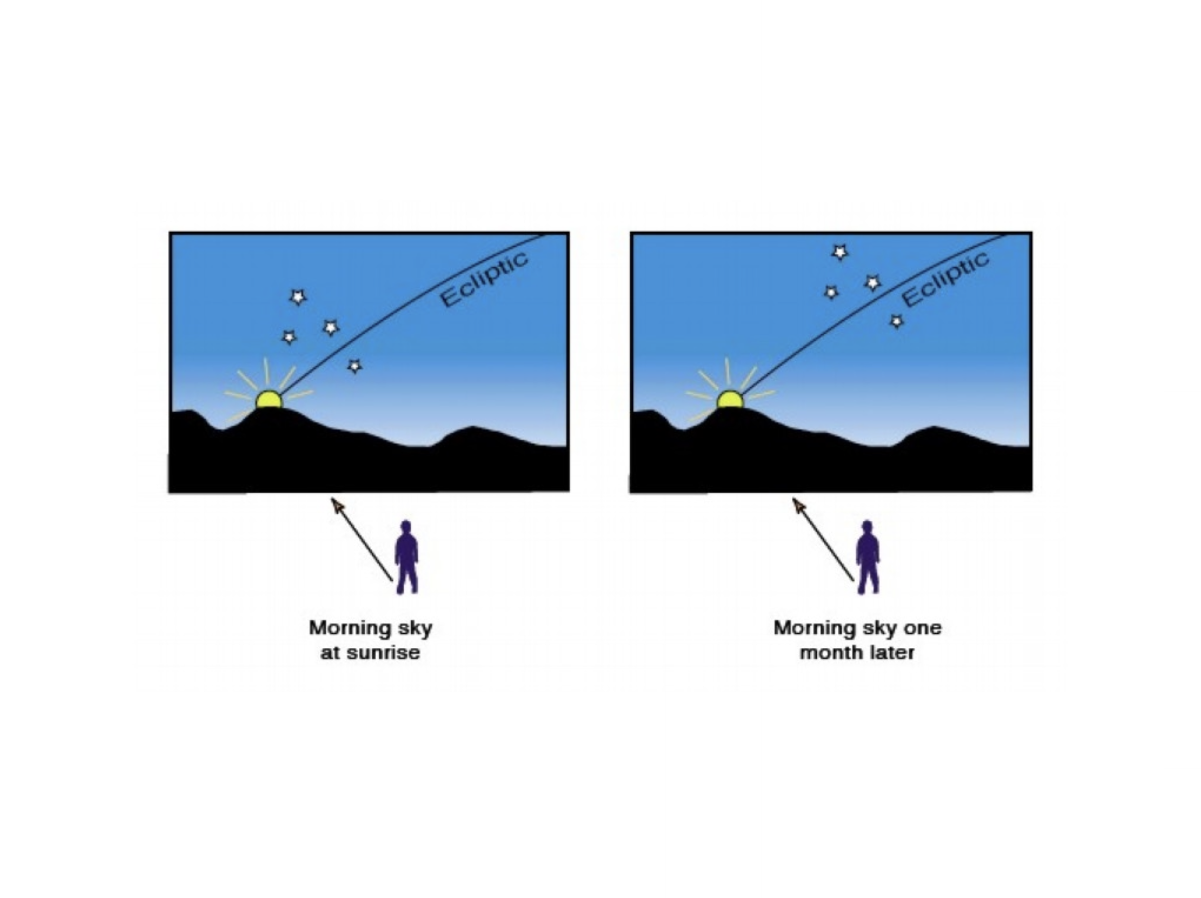
As the Earth orbits the Sun, we see the Sun moving against the background stars. The Sun’s apparent annual path against the background stars is the ecliptic. The planets are always seen within about 18 degrees of the ecliptic, since they orbit the Sun in nearly the same plane. The ecliptic is the zone of planets, as well as the Sun. As the Sun moves along the ecliptic, it passes through particular groups of stars. Ancient observers organized these groups into constellations and named them after particular animals. This group of twelve constellations is the zodiac, which derives from the Greek word for “animals”. These constellations came to be known as the sign of the zodiac, and they are a center piece of astrology. The zodiac includes some prominent constellations such as Taurus the bull and Leo the lion. The majority are more obscure and not easy to identify. Astronomers eschew the term “signs of the zodiac” because of its astrological overtones. For astronomers, the constellations along the ecliptic are the “zodiacal constellations”. In this special region, we see the complex motions of the planets as they orbit the Sun. If you observe the sky at sunrise over several weeks, you can see how the Sun moves eastward against the background stars. A constellation that is near the eastern horizon at sunrise will be considerably higher in the sky at sunrise one month later. The Earth’ position in its orbit has changed, and from this new perspective we see the Sun against new background stars. This annual cycle creates the changing pattern of constellations that are visible at night. It is the natural calendar of the sky.